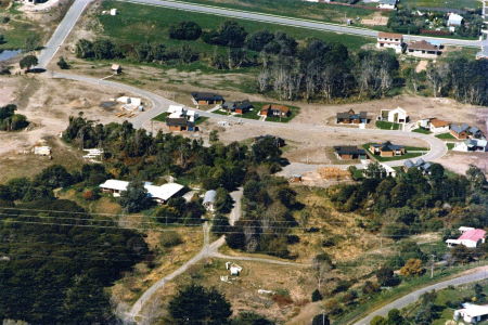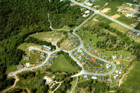
Lloyd Parker believed that a community of 450 persons was an optimum size and would require 60 acres of land. In the mid 1970s the Board purchased 41½ acres that contained a motel complex, which was managed by residents until the buildings were sold and removed some years later.
Initially the Parklands Trust accepted responsibility and legal liability in these transactions, however the Woodlands Trust was later established with a view to the two trusts eventually merging. After long and protracted legal processes, Parkwood Trust purchased the two properties on 31 October 1990 for just over $31 million.
While physical development continued unabated, financial management was difficult. The Residents’ Association increasingly took over the everyday affairs of the village and the communal aspects of life in the village. A particularly important milestone was the establishment on the Board of a position for an elected representative of residents.

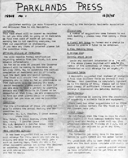
In today’s busy world we are constantly told of the importance of communicating and with modern technology we can do so almost instantly. Life in the 1970s was very different, but early residents of Parklands were indeed forward looking people who realised the importance of circulating information if a soundly based community was to develop. To this end they developed a newsletter that the editor typed up, copied using a Gestetner machine and personally delivered to every household each month.
As the population of Woodlands grew, the Residents’ Association extended its interests to encompass the whole community and provision was made to ensure Woodlands residents were represented on the committee.
The ongoing development of Stage 2 was planned and drawn up by a consulting engineer. In due course a contract was placed for the extensive earthworks required for the first stage of Woodlands. The Board’s intention at that stage was to develop this large area over a period of time, as and when it could be afforded, and then to develop the second part of the Woodlands area. This stage of Woodlands development proved extremely costly and required removal of wet peat, followed by backfilling from a sand dune running through what is now known as Bellbird Crescent. Eventually the whole of what is now Wren Street and Warbler Grove was excavated to a depth of 3.5 metres before being filled with sand from the dunes.
The Chairman’s report of 1979 summed up progress made on ground works: “The landscaping of Woodlands is progressing very satisfactorily. The general environment and the way in which the whole area is developing are the subject of much favourable comment. The terraced north and south banks are full of interest. The entrance development gives the public the good advertisement we are desirous of making. The project is taking shape along the lines of our original plans.”

Wren Street from number 8 onwards was a ‘moonscape wilderness’ arising from operations to provide Waikanae’s public sewage system combined with development within Woodlands. The area that is now a staff car park was reclaimed from swamp and the adjacent pond area was formed to encourage wildlife.
As houses were erected in Wren Street and Warbler Grove, attention was given to Stage 3 of the total project, what we now know as Pukeko Street and Pigeon Grove. Initially, proper access from Ngarara Road had to be obtained. That meant the filling of a gully, and the local Council required a dangerous bend in Ngarara Road to be eliminated and a footpath provided – all at the Trust Board’s expense.
Subsequently, the northern end of Pigeon Grove appeared suitable to build on, but the engineer found what appeared to be the original track cut through bush to form Ngarara Road. At a depth of 6-8 metres there were many large trees buried in swampland.
The peat/sand mix from these excavations was used to form a raft 1.5 metres deep that was then grassed to create what is now the croquet green. The croquet pavilion was subsequently built by staff and voluntary labour. The area behind the croquet pavilion (also swamp) was raised and a walking track was created on the southern boundary. That completed a walking track of 3 kilometres around the whole property.
This section has been adapted from A Place called Parkwood, by Margaret Lythgoe, a history of Parkwood published in 2007.
